“Facts About Underwater Surveys” describes why surveys are crucial to a well-executed dredging project and the technologies and instruments being used.
Underwater or hydrographic surveys are an indispensable part of the data collection process used during dredging and maritime infrastructure works. They establish the contours of the seafloor and subsea conditions and monitor dredging accuracies. They collect data about navigable waters in order to ensure navigational safety as well as to measure whether dredging has been done to the designed depth or correct profile.
The survey data are stored on computers and shared with all involved parties, providing crucial information to project owners and dredging contractors. Surveys for dredging projects are conducted using a wide range of hi-tech instruments, including:
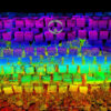
- echo-sounding by single beam or multi-beam echo-sounders to determine water depth;
- Side scan sonar for mapping the seabed and detecting underwater objects (debris, rocks, pipelines, and so on);
- Acoustic Doppler Current Profilers (ADCP) that record water current velocities over a range of depths;
- in-situ density profiler like a towfish to establish “navigable depth”, that is, the physical level within a fluid mud layer which is still safe for deep-draughted vessels; and
- satellite positioning systems like GPS which increase precision when dredging.
Surveying can be conducted by dedicated survey vessels but often survey instruments are installed on inflatable craft, such as Zodiacs, small craft, autonomous underwater vehicles (AUVs), unmanned underwater vehicles (UUVs) or large ships. In other cases surveying equipment are mounted on the dredging ship itself, especially on trailing suction hopper dredgers. When this equipment is mounted on the bow or bottom of the dredger, cross-profiles of the seabed can be exhibited three-dimensionally on a computer as the vessel moves forward. The crew is thus able to anticipate and optimise dredging works and carry out bathymetric surveys as well.
Surveying technologies create a baseline of data before the start of a dredging project. They are then followed by continuous surveys throughout the lifetime of a project. Investing in extensive survey data collection can be costly, but in the long term they decrease the margins of error and increase dredging accuracies, which directly lower overall costs.
“Facts About Underwater Surveys” answers essential questions such as:
- What is surveying?
- Why are surveys necessary for dredging?
- What is a hydrographic survey?
- What is a bathymetric survey?
- What tools are used for surveying?
- What is echo-sounding?
- How does a single beam system work?
- How does a multi-beam system work?
- What is a side scan survey?
- What is an acoustic doppler current profiler?
- What is LIDAR?
- What kinds of vessels are used for surveying?
- What about satellite positioning systems?
- How are drones used for surveys?
- How does surveying support dredging for sand?
- How is surveying for rock works done?
- What other tools are used for surveying?
- How accurate are surveys?
- What are the impacts of survey inaccuracies?
- How can surveying limit conflicts?
- Are surveys cost-effective?