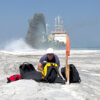
Surveying of the subsea and seafloor conditions of dredging areas are mapped at the start of and at intervals during a project for comparison and control.
Surveying is the science of accurately determining the area of any portion of the Earth’s surface, be it on land or underwater. The general aim of surveying is to measure and fix a position in three dimensions.
In the dredging industry hydrographic or underwater surveys are a prerequisite in the planning and execution of nearly every form of project. Bathymetric surveys are also a part of these underwater surveys. Nowadays data is stored on computers and shared, providing crucial information to dredging contractors and their clients throughout the execution of the project.
Hydrographic surveys
Underwater or hydrographic surveys are part of the data collection process used during dredging and maritime infrastructure works to establish the contours of the seafloor and subsea conditions in order to:
- choose the correct equipment for the dredging operation;
- provide a baseline to measure dredging accuracies;
- provide a baseline to evaluate environmental impacts.
Bathymetric surveys
Bathymetric surveys are used to create a topographic map of the seabed. These surveys use a variety of acoustic sounding tools to measure water depth by bouncing a sound wave from a transducer (a transmitting and listening device) mounted on a ship to the seafloor and then back to a receiver. The depth of the seabed can then be calculated. The data derived from such bathymetric measurements when compiled in a topographic map or chart show the underwater terrain or seafloor relief as contour lines.
Purpose of surveys
Surveys are used to collect data about navigable waters – including oceans, seas, lakes and rivers. The data they collect is used for multiple reasons:
- to ensure navigational safety in ports and access channels to that ships can safely enter and navigate without running aground;
- to help determine the total amount of soil which must be removed from a particular area, both for capital (new projects) and maintenance dredging;
- to check if the design depth has been reached over the entire area after dredging has occurred;
- to inspect completed subsea gas or oil field infrastructures in the offshore industry in comparison to the initial design. For instance, trenches for pipeline laying can be mapped and measured to ensure the proper profile in which to lay the pipe has been achieved. After pipelaying, surveys can measure the accuracy of backfilling with rock.
Data collection
Data for a dredging project must be collected:
- at the site to be dredged;
- at the borrow area in the case of land reclamation;
- at the disposal site in the case of maintenance and remediation dredging; and
- along the route of the dredge between dredging site and disposal or reclamation site.
To have real value, the situation at these sites must be surveyed before work begins and continue during the project and for a period of time after the conclusion of a project. Only in this way can a true evaluation be made of the impact (of lack of impact) of the dredging works.
Surveying and monitoring
Surveying and monitoring are two separate processes, both of which have an essential role in dredging operations.
Surveys are conducted as a part of a project to define the characteristics of soils and subsoils at the dredging site and/or borrow area. Surveys will determine characteristics of the marine surroundings, such as water depth, currents, waves, temperature, salinity, wind, turbidity, TSS and types of sediment.
Monitoring of a project is an exercise in quality and quantity control to determine if a dredging operation is meeting the performance requirements that have been stipulated. Monitoring will determine in land reclamation projects, if the quality of fill is suitable for the purpose of the project; in deepening channels, if the correct depths have been dredged; and in all cases, if a project fulfils the environmental requirements.


