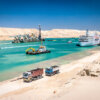
Monitoring equipment provides ongoing data about the quality of soils, quantities of soil and depths being dredged and environmental issues.
This specialised equipment is used for quality control of hydraulic fill and beach restorations They measure if the quantities of dredged material and depths contractually stipulated are being met, as well as to determine environmental impacts of dredging operations.
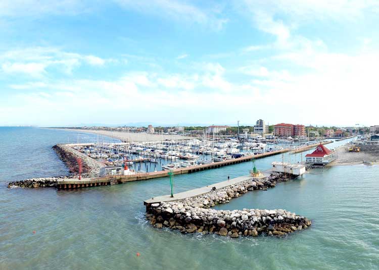
Monitoring equipment
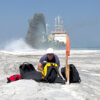
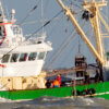
The monitoring equipment is used in situ to achieve measurements of various characteristics, or instrumentation can be placed on dedicated survey vessels or mounted on a dredging ship itself.
Monitoring equipment may include:
- Zone load tests, plate bearing tests and California Bearing Ratio, which are tests done in situ on soil and subsoil of a land reclamation;
- Instruments to measure Trial Embankments;
- Electrical piezometers or open standpipe piezometers which are used to measure pore pressure during hydraulic filling;
- Settlement plates;
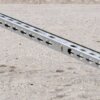
- Extensometers;
- Settlement hoses;
- Inclinometers;
- SASW (Spectral Analysis of Surface) and CSCW (Continuous Surface Wave System), for testing soil stiffness;
- Aerial and satellite imagery;
- Photo frames set up in the seabed to visually observe the marine fauna and flora;
- Water samplers (such as the Niskin);
- Buoys, poles, or frames for point monitoring;
- ADCP (Acoustic Doppler Current Profiler) measures the speed of water moving across a water column and can be anchored to the seabed or mounted on bridge pilings, sea walls, the hull of a ship or lowered on a cable from the surface;
- Global Positioning Systems (GPS) as well as differential GPS (dGPS) and Real Time Kinematic (RTK) positioning are used in the dredging industry, which has greatly improved the accuracy of dredging to within centimetres;
- Drones or unmanned aerial vehicles (UAVs) with lightweight digital cameras are being used for examining the water surface to detect disturbances.
Monitoring the ongoing activity of a dredging operation will give the contractor the opportunity to know in real time if the landfill, beach restoration or correct depths are being achieved or if environmental thresholds are being reached, as the work is in progress.
Subjects
Surveying and Monitoring
-
 Adaptive or feedback monitoring
-
 Compliance Monitoring
-
 Contractual Monitoring
-
 Environmental Monitoring Programmes
-
 Geological and Geotechnical Data
-
 Hydraulic Data
-
 Monitoring
-
 Monitoring Equipment
-
 Morphological and Environmental data
-
 Navigable Depth
-
 Site Investigation
-
 Surveillance or BACI monitoring
-
 Surveying
related
Articles
LIFE MARINAPLAN PLUS Project: Sustainable marine and coastal seabed management
In June 2019, the research team of the LIFE MARINAPLAN PLUS project began operating the first-of-a-kind demonstration plant installation at the harbour entrance of Marina di Cervia (Italy). Fulfilling the project’s objective to apply at industrial scale a reliable technology for the sustainable management of sediment in marine infrastructures, this technology prevents harbour silting through the use of submerged devices called ‘ejectors’ installed on the seabed.
The Smartsediment tool: a QGIS plug-in for evaluating ecosystems services

Managing sediments, especially from dredging, is important for the management of estuaries and coastal areas. When implemented in the right way, a sediment management strategy can be qualified as a nature-based solution as it uses the physical processes of erosion and sedimentation to create added value. There is a need for an evaluation of sediment strategies and the habitats that are created for a wider range of objectives than only biodiversity and nature conservation. The concept of ecosystem services provides this broader framework.
Monitoring of settling and consolidation of mud after water injection dredging in the Calandkanaal

As regular maintenance and relocation of sediment deposits are highly expensive, Port authorities seek more efficient solutions for reducing the costs and CO2 emissions of maintenance dredging. One solution, water injection dredging (WID), is carried out for maintaining the sediment deposits which predominantly consist of clay and silt. WID has been proven to be a cheaper solution by leaving the sediment in place, eliminating substantial costs for relocation of the dredged sediment.
Mapping water quality with drones: test case in Texel

Winning co-author Liesbeth De Keukelaere the Young Author Award, an article about the pilot test case organised at the Prins Hendrik Zanddijk project in Texel, The Netherlands, demonstrating drone technology for water quality monitoring.
Aerial Survey Techniques Applied for Stockpile Progress Measurements

Multicopters, unmanned aerial surveyors, can fly and take pictures in difficult-to-reach or potentially dangerous areas, improving the speed and safety of acquiring data.
Application of Modern Survey Techniques in Today’s Dredging Practice

A review of survey and monitoring techniques as well as specialised environmental systems are realised in an "ideal" vessel.
Facts About
Underwater Surveys

“Facts About Underwater Surveys” describes why surveys are crucial to a well-executed dredging project and the technologies and instruments being used.
News
IADC Fleet list 2023

As a service to the dredging community, IADC releases an updated version of the IADC Fleet List each year.
IADC Fleet list 2022

As a service to the dredging community, IADC releases an updated version of the IADC Fleet List each year.
IADC Fleet list 2021
As a service to the dredging community, IADC releases an updated version of the IADC Fleet List each year.
IADC Fleet list 2020
As a service to the dredging community, IADC releases an updated version of the IADC Fleet List each year.
IADC Fleet list 2019

As a service to the dredging community, IADC releases an updated version of the IADC Fleet List each year.
Publications
Dredging for Sustainable Infrastructure

The book Dredging for Sustainable Infrastructure gives state-of-the-art guidance on how to design, implement and manage a water infrastructure project with a dredging component to project owners, regulators, consultants, designers and contractors.