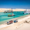
Hydraulic data include measurements regarding water level, currents and waves, which can be influenced by weather-related and environmental events.
These data are relevant for dredging and reclamation projects, for planning and designing reclamation works, as well as for monitoring the works in order to assess the short- and long-term impacts.
Relevant hydraulic data include:
- Water levels (tides and surge) of the area, which will determine the design of reclamation works, as extreme water levels primarily determine the heights of the defence structures and the level of the reclamation itself;
- Currents in rivers, estuaries and coastal areas which are driven by gravity (rivers), density variations, tidal water level variations or wind shear during storms (surge currents);
- Wave data which are important for the design of the surrounding structures of a land reclamation, as well as for planning and monitoring of dredging and reclamation works;
- Water temperature;
- Water salinity.
Weather-related or meteorological data include wind, air pressure, precipitation, air temperature, salinity, visibility and storm tracks.
Subjects
Surveying and Monitoring
-
 Adaptive or feedback monitoring
-
 Compliance Monitoring
-
 Contractual Monitoring
-
 Environmental Monitoring Programmes
-
 Geological and Geotechnical Data
-
 Hydraulic Data
-
 Monitoring
-
 Monitoring Equipment
-
 Morphological and Environmental data
-
 Navigable Depth
-
 Site Investigation
-
 Surveillance or BACI monitoring
-
 Surveying
related
Articles
Study of greenhouse gas emissions during ripening of dredged marine sediment

As increasing greenhouse gas (GHG) emissions contribute to global warming, it is becoming more important to consider the carbon footprint of hydraulic engineering projects. This carbon footprint is more complex than previously thought however, as it can also include the carbon dynamics of the sediments from which projects are built. The purpose of this study was to provide a first approximation from sediment-related GHG emissions of dredged sediments. Using the case study of the clay ripening pilot project (‘Kleirijperij’) in Groningen, the Netherlands, one phase of sediment processing was examined: the ripening of dredged sediments for use as a clay material in dyke construction.
Innovative Modelling: A Tool for Coastal Developments

The Port-La Nouvelle harbour, located in an inlet between Bages-Sigean lagoon and the Mediterranean coast is home to complex hydrodynamics. An innovative package of five interacting hydro-sedimentary numerical models was developed to assess a port expansion project in the area.
Integrated Method for Optimal Channel Dredging Design

An analytical method that was developed and applied to identify the optimal channel layout and dredging depth for safe navigation in the Mearim Port concept in Brazil.
Publications
Dredging for Sustainable Infrastructure

The book Dredging for Sustainable Infrastructure gives state-of-the-art guidance on how to design, implement and manage a water infrastructure project with a dredging component to project owners, regulators, consultants, designers and contractors.
Hydraulic Fill Manual

This manual, a first of its kind, is an ideal reference for all involved in the development of such infrastructure projects.
Webinars
Hydraulic Fill (on demand)

This course is of particular interest to clients, consultants, planning and consenting authorities, environmental advisors, contractors and civil, geotechnical, hydraulic and coastal engineers involved in dredging and land reclamation projects.